 |
| Kahana Valley |
Date - June 19th, 2010
Length - 4 Mile Loop
Time - 4 Hours and 30 Minutes
Short&Sweet - One third awesome, two thirds fail.
The Manamana Trail is a popular hike on Oahu, and it has been dubbed by some as "the most dangerous published hike on the island". It's often incorrectly labeled Pu'u Manamana for the peak that gives its name to the entire ridgeline. The trail doesn't actually reach the peak which, at the time, was thought to be unconquered.
 |
| The trees begin to fade |
I was really stoked for the so called most dangerous hike, and was even having delusions of death defying climbs into the clouds. Annnnnd back to reality. Either my tolerance for drop offs had increased or this ridge was seriously overrated. My guess would be a combination of the two. Either the first third or last third will be awesome depending on which way you make the loop. Myself, Andrew, Jason, Lynnale, Mike, and Rambo took the obscure trail off of Kamehameha Highway.
 |
| Up, up, up |
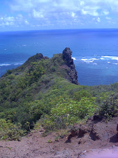
The hike started its upward assault straight from the get go, and not ten minutes in granted us incredible views of Kahana Bay. As the trees fell by the wayside to rocks and dirt, we reached a trail junction. The choice was to either continue heading up the ridge or take a detour to the famed Crouching Lion rock formation. I didn't really see a lion but whatever. All debating aside, we continued going up the ridge. The higher we got the cooler it became. Soon we were granted views of Swanzy Beach a thousand feet below us. I even saw some birds perched right below our break spot. I tried to feed them a rice crispy treat, but they disapproved. Bastards...
Lion? ----->
 |
| Ungrateful birds |
The ridge continued rising, but now it was at a more gradual pace. The ridge was probably about 3 feet wide. Not much different than Olomana, but it felt so much better with the picturesque views in all directions. Unfortunately, all good things must come to an end, and end they did.
 |
| Steep drops |
The farther/higher we got, the more the vegetation encroached on the trail. It eventually became a muddy slog through the ferns. I swear this seemed to drag on forever, Mud ferns mud ferns. If you can make it past this then you will reach the grassy overlook called Turnover, the highest point on the Manamana Ridgeline. According to Stuart Ball's Hiking bible, you are supposed to backtrack from Turnover to a previous junction that not one of us saw. Not only do we all have poor eye sight, but horrible reading comprehension too! We kept reading through the route description, eventually deciding on a trail that branched off Turnover into Ka'a'awa Valley. Said trail lead us to a divergence of paths, all of which lead to no where. This is just a hunch, but I would be willing to bet that we are not the only people incapable of following directions.
 |
| Lush forests |
Andrew ended up finding the junction. He swore he saw it before, I call bs on that. Our newfound path descended rather quickly, but with a lot of mud and no views. The ridge narrowed significantly here. The drops were gradual and overgrown, hardly worthy of the hype they recieve. Andrew and Rambo tried to keep things fresh with small talk, but I don't think anything could drown out the boredom induced by this portion of the loop. About the only noteworthy, and slightly ironic, thing left was the trail ending in a graveyard of all places. Haha, so funny...but not really. Next time, I will definitely not be doing the full loop. I suggest doing the awesome beginning and ending it there.
 |
| Narrow...ish |


No comments:
Post a Comment